People and communities
Sandy Ridge: the long house beside the cranberry bogs
Documented history · Sources compared
A farm map and a census page recover the work and housing of a settlement now easy to overlook.
A house for the harvest workforce
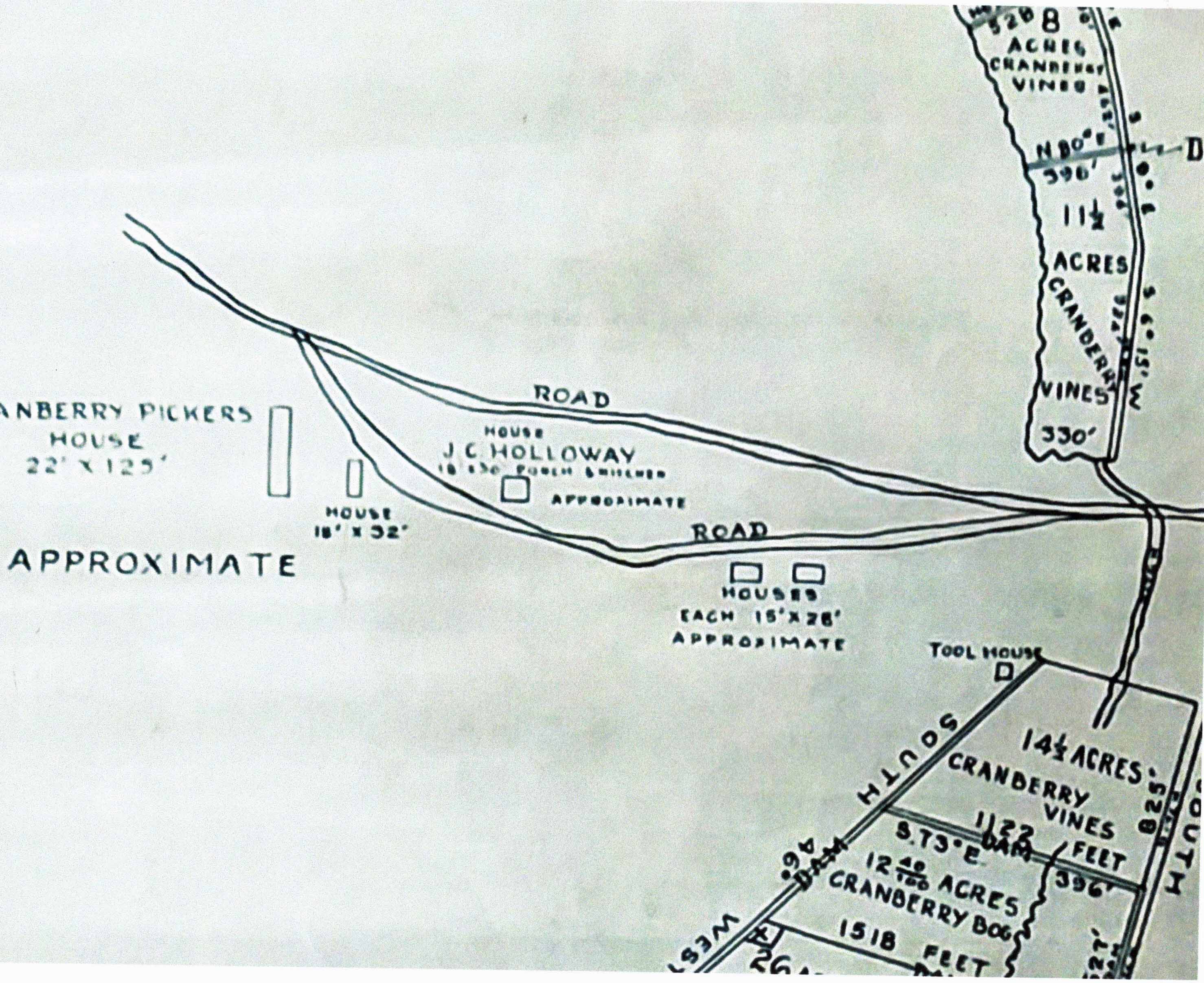
The map reproduced as a 1929 Wharton-estate document labels a cranberry pickers’ house approximately 22 by 125 feet. Smaller houses, J. C. Holloway’s house and a tool house stand beside measured cranberry acreage. Its dimensions make collective worker accommodation visible, but do not establish how many people slept there or their living conditions. Wharton map detail.
The census records different kinds of labor
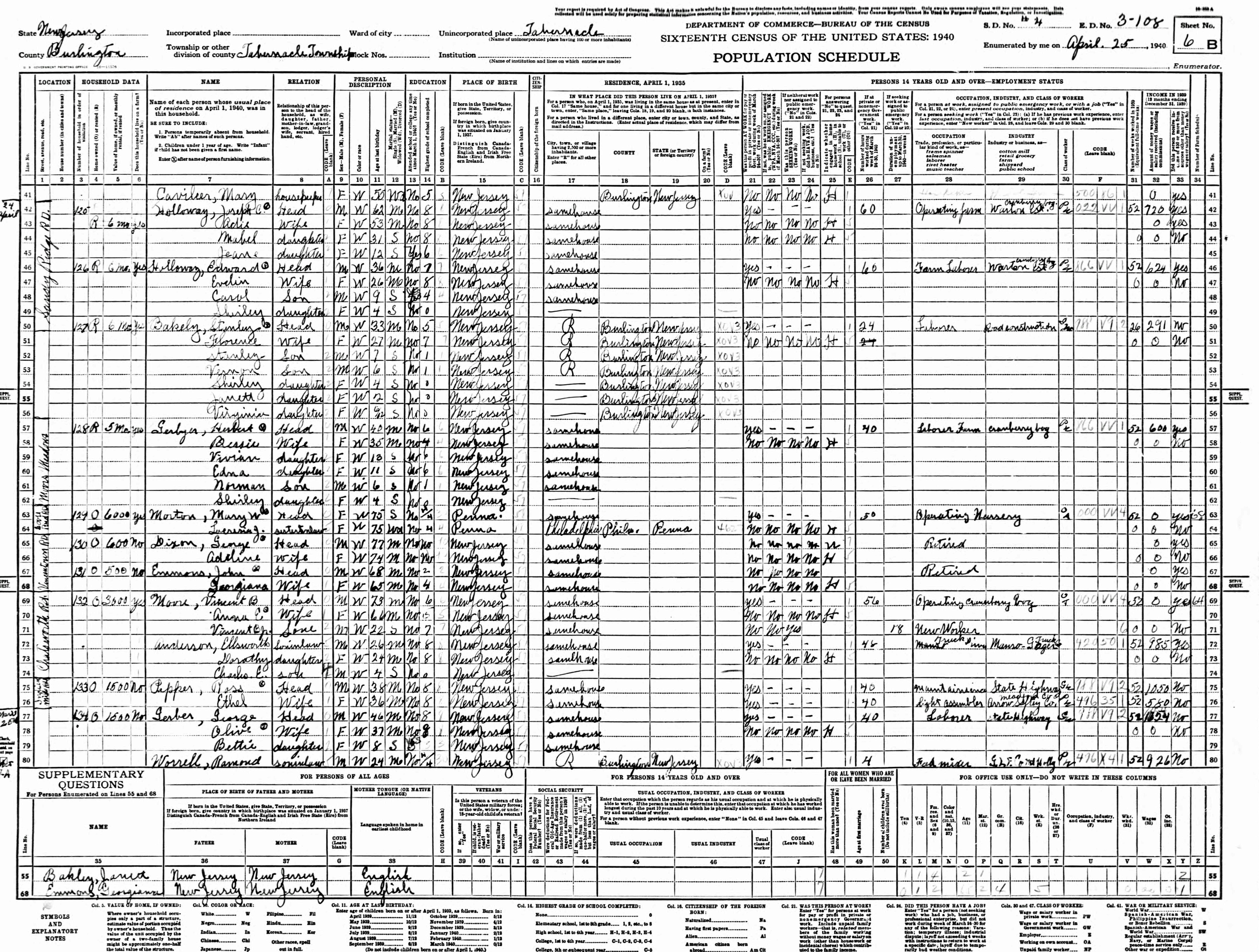
The April 25, 1940 schedule identifies Joseph Holloway with farm operation and Edward Holloway as a farm laborer, both associated with the Wharton estate. Stanley Bakely’s entry instead records road-construction labor. Living in a cranberry settlement did not mean every working resident held the same job. 1940 census, sheet 8B.
A foundation cannot explain itself
The society questions the identification of a concrete block as a sawmill base. Without a machinery plan or excavation, its function remains unresolved. The documentary buildings should not be matched automatically to every modern ruin. THS Sandy Ridge research.
Sources and research limits
The map detail and census page were inspected. The cropped map lacks its full title block, so its date and archival identification follow the society. No archaeological access directions are provided.