Hampton Gate Tavern: deed and map audit (6 October 2026)
Hampton Gate Tavern: deed and map audit (6 October 2026)
Question
Can the tavern building, as distinct from the Hampton Gate locality and a Cavileer-estate lot, be placed on a defensible modern map?
Current answer: no. The 1875 deed supplies usable boundary clues and identifies an apparently extant commissioners’ survey. It does not identify the tavern building. Keep the public map marker at locality precision.
Source ledger
| Claim | Best inspected source | What it establishes | Limit |
|---|---|---|---|
| David Cavileer acquired land from Caleb Cramer on 9 April 1812 for $2,000 | THS deed excerpt; recited again in Burlington County Deeds A9 p.426 | Parties, date, price | Neither excerpt nor 1875 recital proves a hotel stood there in 1812. Full Book Y p.31 not yet obtained. |
| Mary Cavileer had an estate interest and appears on tavern-license list | Will excerpt; 1829 list | Her role cannot be omitted | List is for May 1829 term despite administrative dating; does not locate building. |
| Hampton Gate was offered as a tavern stand to let by William Stokes, guardian of Jesse E. Smith | 30 December 1840 notice | Tavern name, rental offer, guardian, ward | Not a conveyance, occupant list or proof of Mary’s death. |
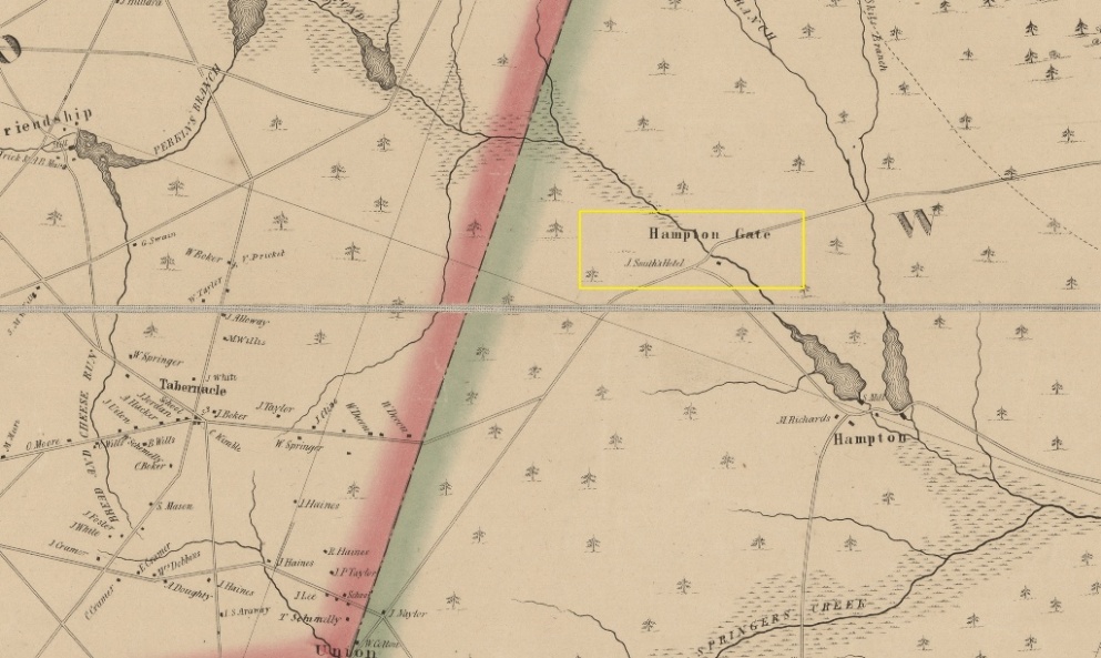
| J. Smith’s Hotel was mapped at Hampton Gate in 1849 | Complete Otley map, Library of Congress; THS detail | Hotel label at settlement scale | Initial cannot be expanded from map; symbol not surveyed position. LOC notes that north is toward the upper left, so screen-side comparisons with later maps are unsafe. |
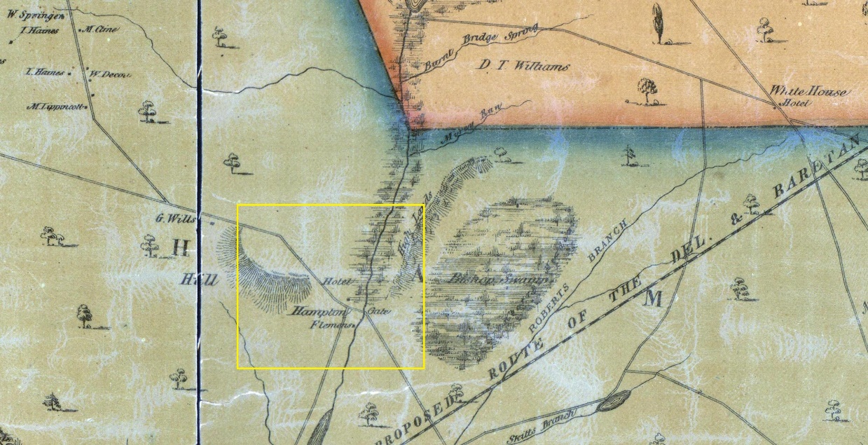
| A hotel is marked near Hampton Gate in 1859 | Complete Parry–Sykes–Earl map, Library of Congress; THS detail | A second independent period depiction of a hotel in the locality | Does not by itself show the same building or fix its location today. |
| Josiah Smith operated a different named tavern | THS Naylor/Buck study reproduces 1826 and 1835 Buck licenses | Strong reason to keep Josiah separate from Jesse pending a connecting record | 1850 Kirkbride directory says Tuckerton Road, too broad to identify Hampton Gate. |
| Commissioners sold Lot No. 1 of a Cavileer-estate partition to Mahlon Prickett | Original Burlington County Deeds A9 pp.426–430, inspected through county guest viewer | Court-process narrative, sale, metes and bounds, survey map reference | No hotel, inn or tavern named in parcel description. |
| Later deed repeats stone-hill boundary | 2022 NJPB forum post quoting 1888 deed | Parcel description survived in later chain | Forum terrain attribution is a field lead; same language is not independent proof of building location. |
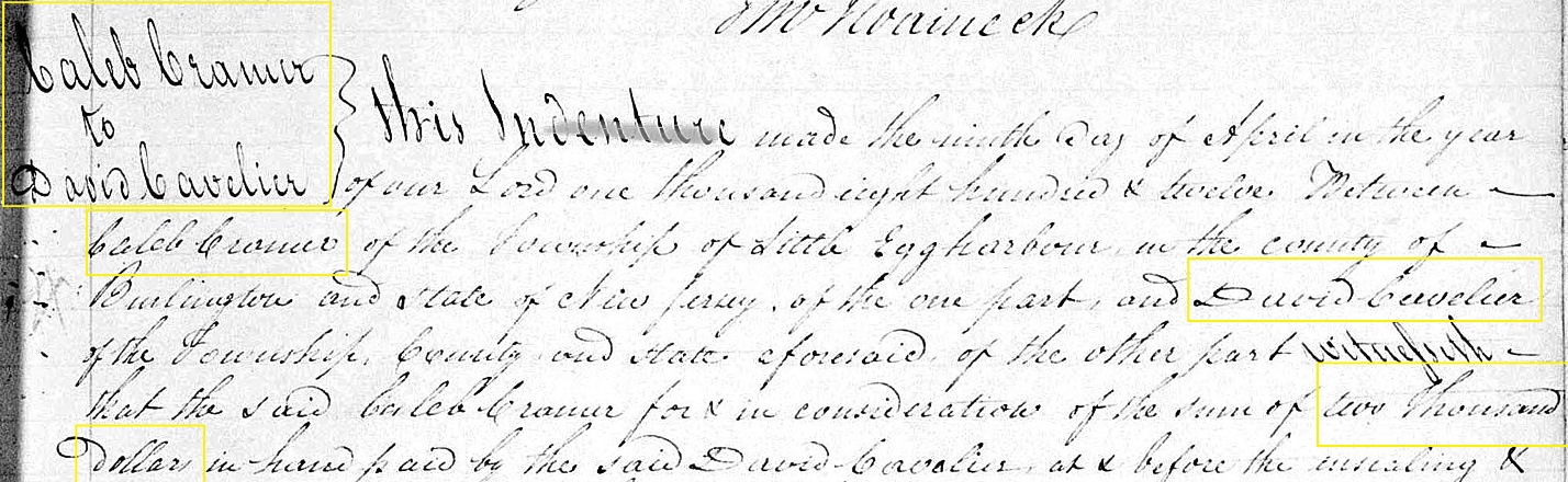
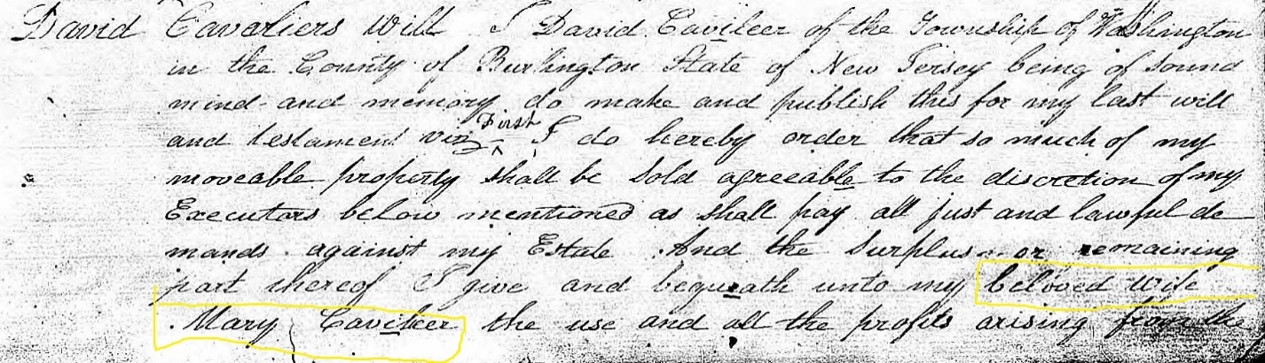
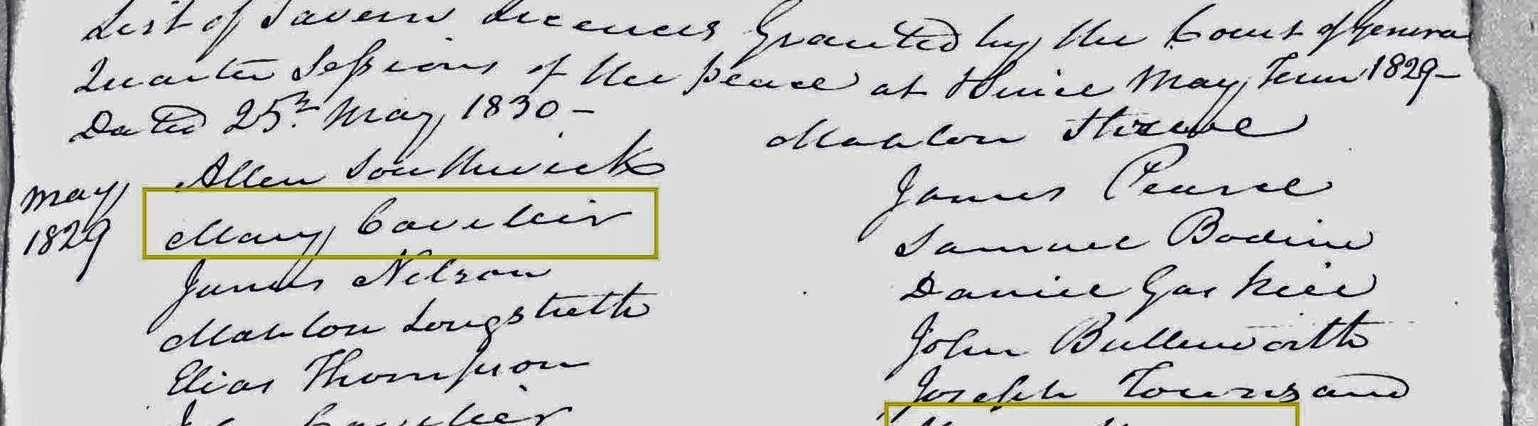
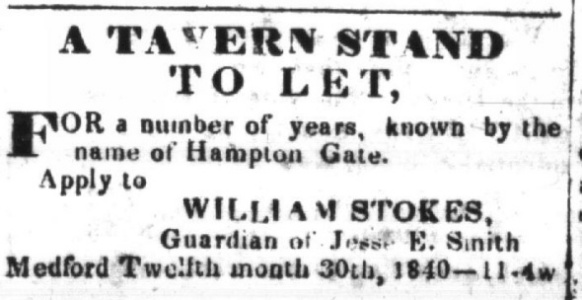
Read of Deeds A9, 426–430
The Prickett instrument begins at the bottom of p.426 (the preceding Charles Lundy deed occupies p.425 and the top of p.426) and ends on p.430 with the acknowledgment, so the complete instrument is A9 pp.426–430, not merely 426–429. Page 430 then starts a different deed. The Prickett deed is dated 6 January 1875 and recorded 26 January 1875. Its grantors are commissioners Maja B. Mathis, Israel Garwood and James Lippincott. The background recites David Cavileer’s 1812 Cramer deed and his 1824 death, Samuel Leeds’s descendants’ interests, and the Orphans Court’s decision to sell rather than physically divide. It says the property was advertised, surveyed into lots and auctioned on Monday 12 January 1874; the weekday matches that date. Mahlon Prickett was highest bidder for Lot No. 1 at $82.41.
Page 429 identifies it as a lot near Hampton Gate, in Shamong and gives the starting point as a pine stump on the south side of a large stone hill near Hampton Gate Bridge, about 15 chains west of the bridge (approximately 990 feet), one chain from the meadow edge. The deed says this is the pine described in David Cavileer’s will as marked “D.C. & S.L.” Its courses run to a stake and stone on a little stone hill, adjoining lots, a road and back to the beginning. The exact directions and closure need independent transcription and a surveyor’s check before geometry is published. “Near” and “about” also limit precision; the bridge’s historic position must be verified. The printed name of the “little stone hill” is descriptive, not evidence of a building.
Critical distinction: A9 proves the location of a lot (relative to old landmarks), not the location of the tavern. A boilerplate transfer of all buildings and improvements is not a statement that a particular building existed. The $82.41 sale is a partition lot; comparing it with the entire $2,000 purchase of 1812 as an indicator of tavern value would be invalid.
The county’s PRESS explanation links to the pre-1965 guest viewer and notes that older recorded maps are not available on PRESS. The county images have session-specific URLs. Book and page are the reproducible citations.
Map hypotheses to falsify
- South of the historic Hampton Furnace road, near the Prickett lot: supported only if the commissioners’ survey or title chain connects a hotel to that numbered lot. Stone-hill boundary alone does not.
- Between road and river at the 1849/1860 map symbols: test by registering the complete sheets to persistent road junctions, bridge and river meanders. The crop cannot yield a precise modern pin.
- North of the road at the 1859 “Hotel” symbol: test whether road realignment or cartographic displacement reconciles this with other maps. A possible later farm ruin north of the road is not evidence of the tavern.
- Josiah Smith = the map’s J. Smith: currently unsupported. His named Buck Tavern licenses give a plausible alternative for the directory entry. Find a Hampton Gate license, deed or tax entry naming him before asserting an identity.
Best next records
- Maja B. Mathis commissioners’ survey for the 1874–75 Orphans Court division of Samuel Leeds descendants’ inherited Cavileer land. A9 pp.428–429 explicitly says a map was prepared and the lots numbered. The most targeted newly located series is the Burlington County Clerk’s Divisions and Partitions of Land guide, CBUCL008: box 3 covers 1864–1884, and the guide also lists Volumes B–C (1819–1896) on reel 1-243 / GSU 848868. These date spans make the series a candidate, not proof that this particular survey survives there. Also check the Orphans Court divisions volume, reel 2-386 / GSU 848874 (the FamilySearch catalog lists digital image group 5670045), and minutes, reel 2-345. The FamilySearch images did not open in this session; no survey was inspected. No outside contact has been made.
- Full 1812 Cramer-to-Cavileer deed, Book Y p.31 as cited by THS. The State Archives deed guide confirms that Burlington deed Books Y and Z (1785–1814) survive on reel 1-46 / GSU 842213. The county guest viewer returned “book and page does not exist” for
Y 31; that portal result is not evidence that Book Y is missing. Its complete tract description could show whether the 1875 lot even overlaps the purchased tavern holding. - Jesse E. Smith guardianship and conveyances, 1840–49, to test succession from Mary Cavileer and identify the 1849 hotel name.
- Full historic map sheets, not just THS crops. The complete 1849 Otley and 1859 Parry–Sykes–Earl sheets are freely accessible at the Library of Congress. Register them with the 1839, 1860 and 1876 sheets against stable hydrography and documented old-road traces, and report positional error. The LOC catalog specifically notes that the 1849 sheet has north toward the upper left; apparent road-side changes in cropped images must be tested after orientation and road alignment are accounted for.
No new building coordinate should be placed on the public map until a parcel-to-tavern link and a reliable georeference both exist.